SHORT - SECTION THREE
Updated: Aug 11

MINNEHAHA FALLS
RECOMMENDED TIME WINDOW: 1:55pm - 4:45pm Disregard if doing A La Carte or going at own pace WALKING DISTANCE: ~2 MILES

MINNEHAHA REGIONAL PARK Welcome to Minnehaha Regional Park, one of the best parks in the Metro! The turn-of-the-century feel of this recreational space is so charming. Yes, the main event is the falls themselves, but it is a jumping off point for one of the coolest hikes in the area, numerous picnic spots, a water splash pad, playgrounds, a huge dog park, historically important natural springs, and a restaurant in the middle of everything that invites people to sit, visit, converse and just BE outside in nature. Everyone in this park, or at least a majority, is in good spirits.
A to B 1:55pm - 2:10pm

Having entered Minnehaha Regional Park just past the crosswalk on Hiawatha Ave., turn right on the Minnesota Valley State Trail pathway. Take the first left and go across the small road, S Minnehaha Dr., and you’ll be near a small parking lot.
Turn left and walk up the pathway to the first intersection of paths. Take a right and stand in front of the house that resides here.

This is the John H. Stevens House. Stevens was a settler in St. Anthony in 1849. He built the first wood frame house on the west bank of the Mississippi River (between where the present day Hennepin Avenue Bridge and the art deco Post Office stand), although it is technically the second ever house in Minneapolis, the first being the Ard Godfrey house in Northeast Minneapolis, a few blocks from St. Anthony Main. The house was relocated here in 1896 by a team of 10,000 school children “tugging on huge ropes in relay fashion”. (minneapolisparks.org).
The house was a hub of “civic and social activity, and was dubbed the ‘birthplace of Minneapolis’. In the Stevens’ home, the name ‘Minneapolis’ was chosen, Hennepin County and the Minneapolis school district were organized, and the idea for a state fair originated.” (John Harrington Stevens House Wikipedia)
In 2022, three separate fires were started on the property in three acts of arson. The house may or may not be sealed off upon our visit due to restoration.
A statue of Stevens is onsite as well.
Now, turn back around and head back to the main path we just took from the parking lot next to S Minnehaha Dr. Turn right and walk along the road up to the next intersection of paths. Cross the street and stand in front of the Minnehaha Depot, aka the “Princess” Depot.
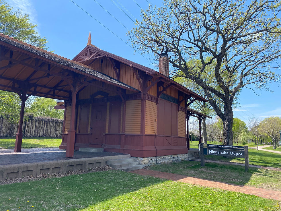
This Depot was one of three stops on the first railroad line west of the Mississippi to connect Minneapolis with Chicago. Built in 1875, it’s named “Princess” due to its “delicate gingerbread canopy” (minneapolisparks.org). This stop was used by residents as they flocked to Minnehaha Park by train on summer weekends. Passenger service ended in 1920 and remained a freight station until 1963.
Turn back and cross the street again to the northeast side. Go back to the path. Turn left. Take the second right. This path leads to stairs that go down to a bridge which crosses Minnehaha Creek just above the falls.
Go down the stairs and take the path to the right, skirting the edge of the creek and the cliff that appears.
Right around destination B will be a plaque commemorating where Lyndon B Johnson once stood admiring the falls. This is a great place to stop and see the main event!
MINNEHAHA FALLS 2:10pm - 2:15pm The name of the falls is derived from Dakota people, meaning mni (water) and haha (curling). It is one of the final features along Minnehaha Creek, which starts at Lake Minnetonka, 21 miles to the west, and ends 3/4 mile to the southeast at the Mississippi.

Minnehaha Falls was made famous by Henry Wadsworth Longfellow in “The Song of Hiawatha”. The poem tells of Hiawatha, a Native American hero who falls in love with Minnehaha, a Native American woman who later dies during a severe winter (Minnehaha Falls Wikipedia). A statue of these two fictional characters is back by the bridge just above the falls. Though adapted into many forms of inspired media, the most famous was Walt Disney’s use of this poem, changing Hiawatha into a small boy whose pants keep falling down, in his short Silly Symphonies film “Little Hiawatha” (1937). Comics based on this character were in newspapers in the early 1940s.
The falls are 53 feet tall. 10,000 years ago, the falls was actually Saint Anthony Falls (!), which emptied on the Mississippi where it met the glacial River Warren, where present day Fort Snelling is. As Saint Anthony Falls eroded 4 feet per year, it passed Minnehaha Creek, where it split into two waterfalls, the new one eroding to its current position in front of us.
Minnehaha Regional Park is also a locale symbolizing the unification of the Twin Cities. Whereas Saint Anthony Falls was sought after by Major Joseph Plympton of Fort Snelling, separating the settlers at the confluence into two main camps and thus creating the growth of Twin Cities, Horace Cleveland in the 1880’s attempted to unite the Cities by a series of parks and parkways connected by trains and boulevards. He is the main reason we have the most amount of parkland in any US city. He tried to maintain the original beauty of the area, and convinced both Cities to agree with him. ("Becoming the Twin Cities: Swindles, Schemes and Enduring Rivalries" by Drew M. Ross)
Minnehaha Falls was the center from which all of the parks would be connected via the Grand Rounds Scenic Byway, connecting the Cities over the Mississippi River gorge with a few bridges and parkways that spanned the gorge’s edge.
Soak this sight in. It’s truly one of the best gems in the Cities.
The creek is unique, too, as 95% of its entirety can be traversed via kayak/canoe from its start at Lake Minnetonka to just above the falls (and save for a small portage halfway in between due to a dam/waterfall). The rest can be hiked alongside to its end at the Mississippi. We’ll do that portion soon!
First, though, let’s take a well deserved break!
SEA SALT (Open April to October) 2:15pm - 3:30pm
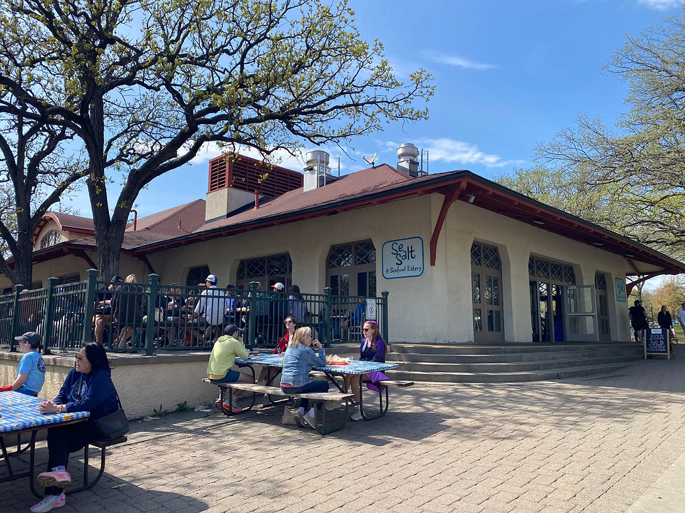
From the falls, locate the large building close by. It has a wonderful restaurant inside called Sea Salt.
This place specializes in cheaper quick-service sea food and craft beer, perfect for a mid point snack on the Itinerary!!! Oysters, fried calamari, fish and chips, walleye mixed with a local beer (Surly, Summit, etc.) or refreshing N/A drink sounds perfect!
Real quick: if you're wanting just a beer or ice cream, there are separate lines that are shorter than the main line, thankfully. Ice cream is on the south side on the patio, beer is in the building in the middle in a covered alcove.
If you're wanting all the fixin's, head up to the northern side of the building to get in line. It might seem long, but it goes pretty quickly. I personally like getting a drink in the middle alcove and then waiting in the main line. Makes the wait a little more bearable!
If the weather is nice, after we order, let’s take our order number and sit out on the patio near the southeast corner of the building (the blue Sea Salt sign is painted on the building), nearest the falls.
This is my personal favorite spot in the entire park. There’s something calming yet exciting seeing the joining of nature with the machinations of an old-timey park vision. The excited visitors going by, marveling at the falls, one of the main attractions that drew visitors since the 1820s to the area. Hearing the roar of the falls crashing below in the narrow gorge. The high trees presiding over all in rustic splendor. Sitting back, enjoying a cold brew, waiting on your snack to come, is the coup de gras. Enjoy!
RESTROOMS: This is a good spot to heed nature's call, if need be. They're in the middle area of the building in the covered alcove.
MINNEHAHA CREEK
3:30pm - 4:45pm
Satiated on food and brew (and some water, let’s be kind to ourselves), let’s bus our garbage and head back down to the falls lookout point.
B to C

From the stone wall, head to the left. Take the path that branches off to the right down a steep stairwell into the gorge.
If you come during the cold season, there will be a gate barring your way. You most likely will see people down in the gorge anyway. Should you climb over the stone fence and traverse the path anyway? Again, since this is a public business and tour, I must say “Maybe look for another way down there.” But if you do climb over, you're doing so at your own risk.
Once in the gorge, take the little spur off to the right that gets close to the falls. Stop. This is a great picture spot, usually with a line of people waiting to do just that.
This is such a great spot to view the falls. Now, I know what’s probably going through your head. “Could I kayak that?” Well, a kayaker once went down it in 2014 with nothing but a scrape to their upper lip. The Park Board seriously warns against doing so. All those pesky boulders at the bottom. If it wasn’t for those . . . I mean, would you . . . ???
If that thought didn’t cross your mind, thank God for you! You are the types of people that bring stability to the world!!!! Talks the rest of us off the proverbial ledge.

Turn back and take the bridge off to the right across the creek. At the other side, stop. People will most likely be taking a non-official dirt path up to the falls on the far side of this bridge . . . Again, there are two kinds of people, in this instance . . .
In winter, people definitely utilize this path to get up to the frozen falls, which is absolutely magnificent to behold. Lots of people climb up into the alcove behind the falls and snap really gnarly pics of the frozen backside. Having kneeled in the shadow of the awe-inspiring behemoth of ice myself, I must say the constant breaking and falling of ice sheets really decided me on whether or not to climb up into the alcove. Meaning: hell no. I’ve seen that action/adventure movie death scene before.
Continue down the main path, which skirts the right bank of Minnehaha Creek, which is rushing past in a quaint rapids. This wooded path eventually comes to another bridge with an ol’ swimmin’ hole on the other side. Go past it, continue down the right bank.
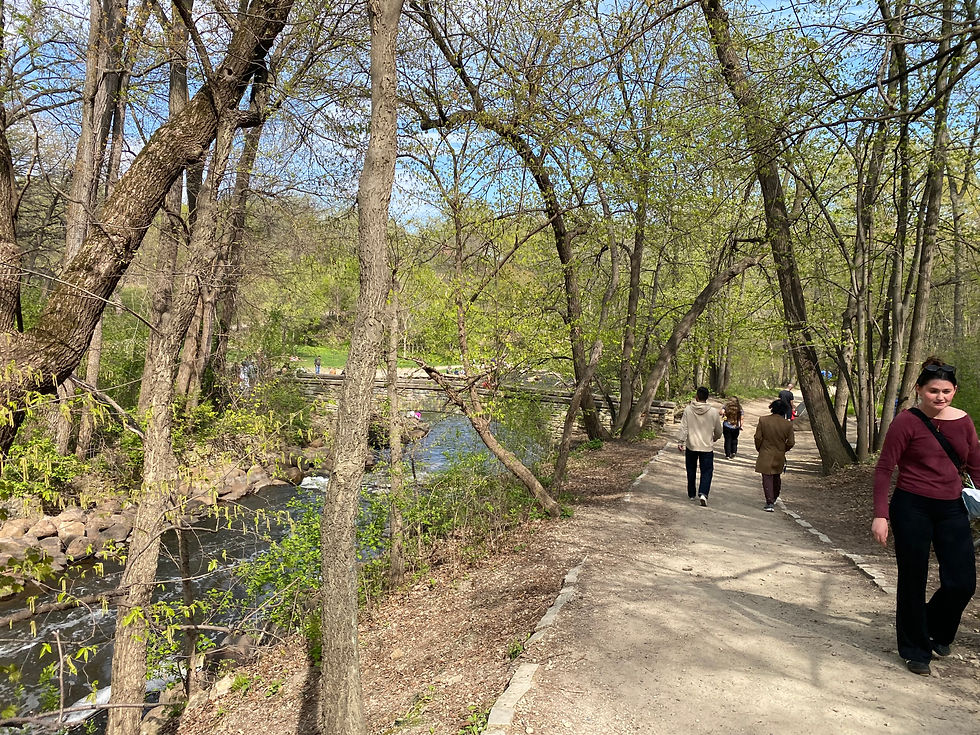
We’ll turn to the right, and come to a bridge over the creek. Turn left and go over the bridge to reach the other side, the left bank, and destination C. Stop.
C to D

Why are we on this side of the creek? I feel like the right bank is prettier coming back (I suppose that would be the left bank in that perspective). So, something to look forward to!
Continue southeast down the left bank.
We’ll go under a really high bridge. This leads to the Veterans Home.
Keep going, past another bridge across the creek (don't cross it).
Eventually, we’ll reach a sandy beach area along the Mississippi. Let’s go down to it! This is destination D. Stop.

Off to the left is the massive Ford Dam (referred to earlier in Section 1 at the Upper Dam). This dam allowed for boats to travel past St. Paul up to Minneapolis. We can really get a sense of what traveling on the river is like by the lock on the left side. Where the boats have to wait depending on the water levels in the confined space, get granted access, have the door close behind, the water either goes up or down, and then the door in front of you opens to send you on your way. It’s such a cool feat of engineering to control water levels in that way, I never tire of Mississippi River Tours that travel through these locks!!
To our right is the dog park on our side of the river and Hidden Falls Regional Park on the opposite. Around the bend is Fort Snelling, the site that really allowed for European settling to be possible in the 1820s. One could consider Fort Snelling to be one of the most important locations in all of Minnesota. Without it, there wouldn’t have been a Minnesota! So much has happened there, in order to understand the story of Minnesota, there’s no more important place to visit.
Go to our Itinerary: “History of the Twin Cities: Part One” to follow the story and to visit Fort Snelling!!
D to E
Time to head back up creek!

We’ll hug the limestone, Glenwood Shale and sandstone cliffs up the (now) left bank. This side of the creek seems just a bit more adventuresome than the other side. When coming to any forks in the path, choose the fork closest to the creek. Traverse back under the high Veterans Home bridge, and come back to the spot where we took the bridge over to C. This is destination E.
E to F

Keep going up the left bank back to the bridge presiding o’er ye ol’ waterin’ hole, fer lan’ sakes! This is a fun wading area for kids and adults alike.

Take the bridge over and we’ll find ourselves at destination F. Stop.
F to G Now, we’ve got a climb ahead of us.
Head up the steep stairway to the top of the gorge. If you’re having trouble or fatigue, don't hesitate to take breaks.
Once up top, check out the Song of Hiawatha garden. I really get a sense of how important that story was for this region, here.

Join the path skirting the stone wall and edge of the cliff to the gorge. Follow it around the curve to the left and we will have reached destination G!!! Last destination for this section of the Itinerary.
Keep going back to the falls lookout for one last look. Stop. Take it in, since this is it.
Sigh.
Sources for information gathered for this section, and if you desire further reading: John H Stevens House
Comments